
Overview

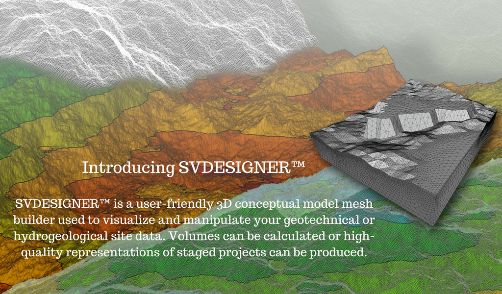
SVDESIGNER™ is a user-friendly 3D conceptual model builder used to significantly reduce model creation times by visualizing, optimizing, and merging engineering staged construction/design, topology, borehole, piezometer/field instrumentation geotechnical data into a well-defined conceptual model for subsequent numerical modeling. One of the most difficult aspects of designing three-dimensional models is the manipulation of three-dimensional geometry. Whether it is the representation of complex geo-strata or the representation of geotechnical designs such as roads, embankments, or tailing dams – such structures are often most suited for three-dimensional analysis but are difficult to describe to the computer. SVDESIGNER™ is a three-dimensional conceptual design tool for geotechnical engineers. It can import three-dimensional geometry in most standard formats such as AutoCAD DXF files.
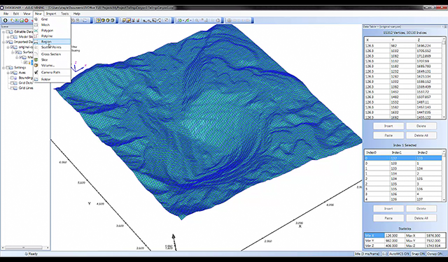
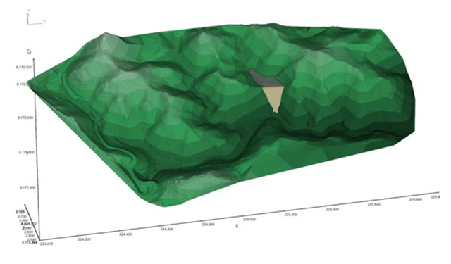
Geo-strata can be imported based on borehole data or in a number of different formats. Once in the software, the surfaces can be represented as grids or as triangulated surfaces (TINs). There are also advanced features in the software to handle intersections of various surfaces so the 3D geometry can be represented accurately.
Key features and enhancements of SVDESIGNER™:
- Easy to Use:Featuring a familiar user interface with easy to understand icons and functions. The software tools behave exactly how you would expect with a short learning curve. You will be able to start modeling right away.
- Field data integration:field data such as piezometer data can be pulled from the sensemetrics cloud platform to display piezometer locations and water levels as a function of time. Groundwater surfaces can be interpolated as a function of time and integrated with a slope stability analysis.
- Borehole import:an interface which allows the import of lithology data from a CSV file or a gINT database has been incorporated into SVDESIGNER™. The new interface is comprehensive and allows boreholes to be located on a site, visualized in 3D and integrated with design or topology data, as well as allowing the development of fence diagrams and 3D interpolation of geostrata layers. The import feature provides an ability to transition borehole data into a full 3D conceptual model of a site for subsequent numerical modeling.
- Representation of Complex 3D Surfaces:3D surfaces can be imported from a variety of formats and represented as grids or triangulated surfaces (TINS) consisting of hundreds of thousands of individual elements.
- Filling Curves:Compute elevation versus volume as a graph.
- Multiple 3D model-building methodologies:Perform extrusions, 2D cross-section stitching, 3D layer cake, block modeling, or the material volume method. 3D models can be sliced into 2D cross-sections. Intersections of complex surfaces can be accomplished.
- Geometry Editing:A rich variety of functionality is implemented in the software to allow editing of existing geometry to represent the integration of new geotechnical designs with existing topology. Editing features integrate with both surface grids and meshes.
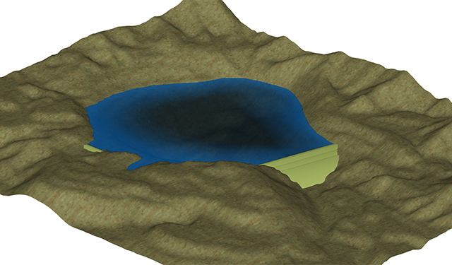
- Surface Cuts / Excavations:Cuts into topography can be easily performed as per the design of a road cut into the side of a hill. Mining cuts such as with open pits can also be represented.
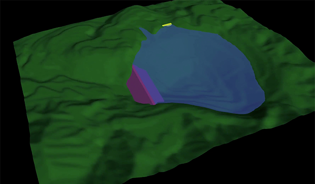
- Construction Sequences:Sequences of layers or lifts of material as placed in earth dams or in mining operations can be easily represented in the 3D conceptual model.
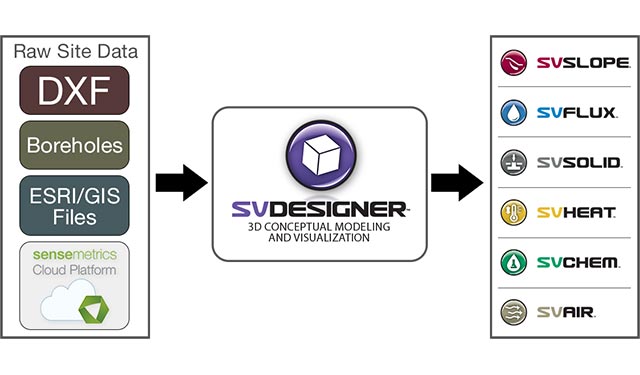
- Supported Import File Types:The majority of common 3D file storage types are considered. This allows SVDESIGNER™ to provide an amalgamated 3D site view of relevant data on a consistent coordinate system. Supported file types include: OBJ; 3DS; Plain ASCII; DEM; DTM; DXF; ESRI grid; LandXML; SVOFFICE™5 and SVOFFICE™2009
- Generate Depositional Surfaces:Generate a set of slurried depositional surfaces for a user-defined filling scenario
- Filling Curves:Compute elevation versus volume as a graph
- Volume Calculations:Volumes of material can be calculated to aid in construction activities.
- Export to Numerical Modeling Modules:2D or 3D representations of geometry scenarios can be exported to any of the SVOFFICE™5 numerical modeling modules for analysis. Exported models can utilize grids or triangulated meshes.
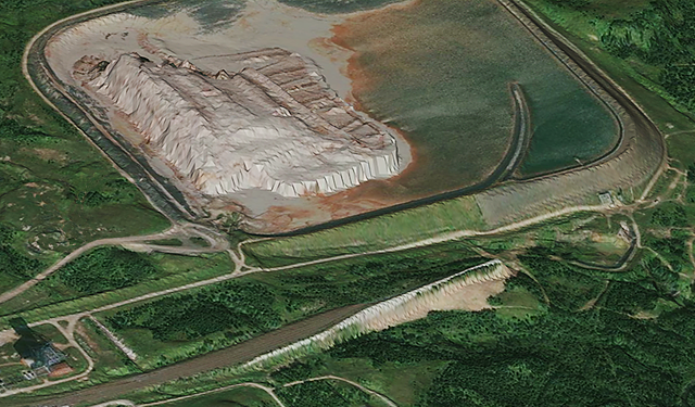
- Stunning Client Visuals:3D conceptual designs can be captured for display to clients and review of potential designs. Image draping of aerial site photos is supported. Fly-bys of sites can be created and exported as animations.
- World Class Support:Highly dedicated team with tracking and fast response to raised issues - typically within 24 - 48 hours
Details
SVDESIGNER™ also has tools to easily describe geotechnical designs into the 3D world. Standard cut and fill operations for roads, embankments, earth dams, and tailing stands are provided and allow easy entry of complex structures. Volume calculation functions then allow subsequent calculations of material requirements for construction purposes.
The software is designed to allow geotechnical engineers to quickly prototype designs in 3D.
Once a site or design is prototyped the volumes of materials can be calculated and subsequently used in construction processes. SVDESIGNER™ also acts as a manager of three-dimensional data for subsequent numerical modeling. Once three-dimensional geometry is created it can be subsequently output to numerical models in the form of 2D slices or as full three-dimensional models comprised of either grids or meshed surfaces.
SVDESIGNER™ represents a new paradigm for geotechnical design in that the full three-dimensional site geometry is represented. Subsequent 2D or 3D numerical modeling activities can be initiated based on professional judgment of the project engineer. Overall design and prototyping time is reduced in this system. The complexity of 3D numerical models that can be created in a short time frame is also improved.