Overview
Complete Stormwater, Sewer and Floodplain Model.
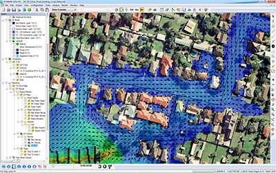
xpswmm is a fully dynamic hydraulic and hydrologic modelling software that combines 1D calculations for upstream to downstream flow with 2D overland flow calculations so that you can see what truly happens to your stormwater system, foul water system or floodplain when waters flow, populations increase or catastrophic events hit.
Its use over the last 25 years, as well as its UK Environment Agency benchmark testing and U.S. FEMA approval, has made it one of the most stable and well-used simulation software programs in the world.
xpswmm allows integrated analysis of flow, pollutant transport and sustainable design measures in engineered and natural systems including ponds, rivers, lakes, overland floodplains and the interaction with groundwater.
Applications
Floodplain Management and River Systems
- 1D/2D River Hydraulic Performance
- Floodplain Mapping and Flood Hazard Analysis
- Evacuation Route Planning
- Interior Drainage (Levee-Protected Areas) Analysis
- Culvert and Bridge Hydraulics
- Fully Coupled Urban and River Drainage Systems
Foul Water and Combined Sewer Systems
- Capacity analysis and collection system optimisation
- CSO and SSO mitigation planning
- RDII (rainfall-derived infiltration and inflow) studies
- Real-time control system performance
- Water quality analysis
Stormwater Management
- Stormwater master plans
- Major/Minor or dual-drainage systems
- Watershed management master plans
- Hydromodification
- Contaminant & sediment loading and transport
- Pollutant removal
- 1D/2D urban flooding
- Detention pond optimisation
- Interconnected pond routing
- Stormwater system design
- WSUD and BMP analysis
WHY xpswmm?
Holistic Modelling
Hydrology, Hydraulics and Water Quality. Experts know that a change to one element in a system may affect the performance of the entire system. xpswmm allows you to fully evaluate the interaction of all system elements — channels, pipes, streets, control structures, ponds, weirs, pumps, catchments, groundwater table, overland floodplains, rain gardens, infiltration trenches and more in a single model.
Regulatory Approval
Widely used and accepted in private practice, it is also been rigorously tested by the U.K. Environment Agency, as well as tested and approved by the U.S. EPA. Countless regulatory organisations around the world are familiar with xpswmm and prefer modelling performed with its powerful tools.
Accurate Simulation
You need a tool with model elements that accurately reflect the physical realities of your systems. The number of available element types, shapes and control parameters are unparalleled compared to free or competing proprietary software packages. Minimise the need for approximations and "modelling tricks" by using xpswmm.
Localisation
The software has been customised and localised for many niche markets around the world. Specific hydrologic methods, specialised hydraulic routines and purpose-build output templates will help you model according to the requirements of your local reviewing agency.
Easily Convey Results and Data
Innovyze offers a unique free Reader of xpswmm models called xpviewer. Users encrypt models with this add-on module so that others can view an un-editable model. This is extremely helpful to consultants as they convey their modelling approach, and invaluable to reviewing authorities who want to see model details without investing in a full license.
Industry-renowned Support.
Nothing is worse than facing a deadline and wasting time trying to troubleshoot an error. xpswmm is supported by engineers who have used the software in the professional world. They understand your need for urgency and are driven to help you succeed.
xpswmm equips engineers with tools for accurate analysis and thorough reporting:
- Review results in nearly any format, from text files and fully customisable xptables to animated profile, cross section and plan views
- Compare results for various scenarios including 2D layers with the Scenario Manager
- GIS and CAD integration allow you to easily create models from external data. No need to own any other program to use xpswmm!
- Import from or export to SWMM5 model formats
- Simulate parallel flows - model street flow alongside underground systems and situations where flow is limited by inlet capacity
Special Applications
- Hydromodification
- Braided River Systems
- Wastewater and Combined Sewer System Management
- Capacity, Management Operations and Maintenance (CMOM)
- Evacuation Planning
- Sustainable Drainage Analysis (LID, WSUD, SuDS)
- National Pollutant Discharge Elimination System (NPDES)
- National Flood Insurance Program (NFIP)
XPSTORM Modules
XP2D
Multiple Domain
XPVIEWER
Real Time Control
XPWSPG