Environmental Data Management
Hydro GeoAnalyst.
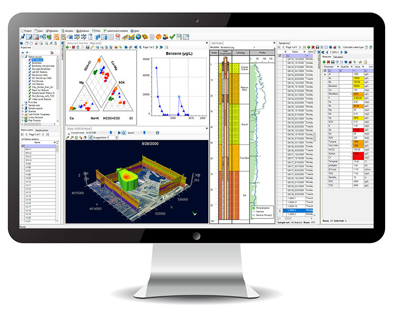
Hydro GeoAnalyst (HGA) is a comprehensive environmental data management system that integrates customizable database structures with state-of-the-art tools for statistical analysis, professional 3D visualization, and intelligent data validation.