+91 40 23549924/8905

info@lagasys.com

SMS 13.0

The Complete Surface-water Solution

Overview

Access a full range of coastal and riverine solutions with SMS - the leading application for surface-water modeling.


Example blog post alt

Flexible modeling approaches

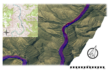
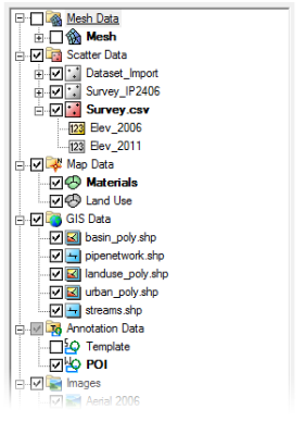
Aquaveo pioneered the conceptual model approach. Build a conceptual model in SMS by constructing a high level representation of the model using familiar GIS objects: points, arcs and polygons. Work with large, complex models in a simple and efficient manner by using the conceptual modeling approach and easily update or change the model as needed.

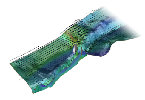
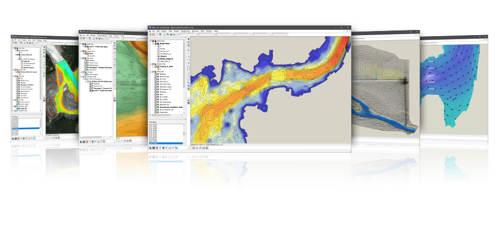
SMS also has powerful tools to build meshes and grids.


Example blog post alt

3D visualization optimized for performance

SMS is the most advanced software system available for performing surface-water simulations in a three-dimensional environment.

  • Interact with models in true 3D
  • Optimized OpenGL graphics for improved hardware rendering
  • Create photo-realistic renderings
  • Generate animations for PowerPoint or web presentations
  • Drape images over the model and control the opacity
  • Annotations – Add north arrows, scale bars, reference images, company logos, and more

Example blog post alt

Import a variety of data formats & imagery

Models require data from many different sources. That’s why SMS is built to easily import numerous file types:

  • Raster images including georeference and projection support
  • Topographical maps & elevation data
  • Elevation & bathymetry data
  • Web data services such as TerraServer
  • ArcGIS geodatabases and shapefiles
  • CAD files including .dwg, .dgn, and .dxf formats
  • Worldwide projection support including Cartesian and Geographic Systems
  • File Import wizard for delimited text files and spreadsheets

Example blog post alt

Advanced riverine & coastal modeling

SMS interfaces with a wide range of numerical models for applications including:

  • Riverine analysis
  • Contaminant transport
  • Sediment transport
  • Particle tracking
  • Rural & urban flooding
  • Estuarine
  • Coastal circulation
  • Inlet & wave modeling

System Requirments

Operating System Windows 7
Windows 8/8.1
Windows 10
RAM 4 GB (8GB or more recommended)
CPU SMS software is CPU intensive. Some models and utilities integrated with SMS can take advantage of multiple processor cores simultaneously. We recommend the fastest CPU your budget allows.
Graphics Card For all display features to be enabled, OpenGL 1.5 or higher must be supported. The use of a dedicated graphics card is strongly recommended. Integrated graphics cards are often problematic.
Display Resolution 1920 x 1080 or greater